About
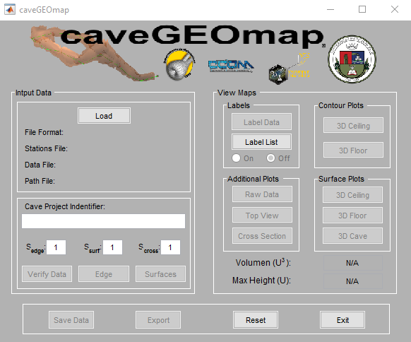
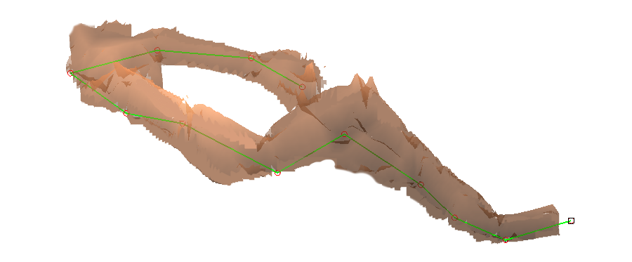
caveGEOmap is a MATLAB® written code for educational purposes developed by the Applied Mathematics Research Laboratory at the University of Puerto Rico at Arecibo (UPRA). Developed by the Department of Mathematics in collaboration with the Physics-Chemistry Department, caveGEOmap uses cave measurements to create 2-D and 3-D maps of a cave with minimal user work. Data is collected using standard digital laser distance measurer, clinometer and a compass and the measurements are treated as data points from a two variable piece-wise function that are then used to interpolate the cave surface. As a user friendly cave mapping software, caveGEOmap evaluates the given measurements using spatial analysis and uses the data itself to estimate the necessary variables to produce the 2-D and 3-D cave maps.
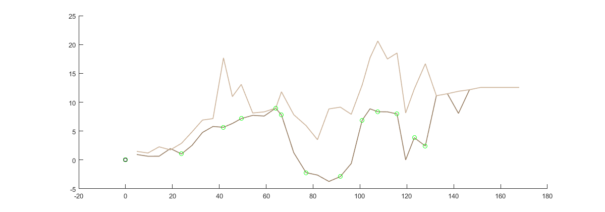
Matos Cave:
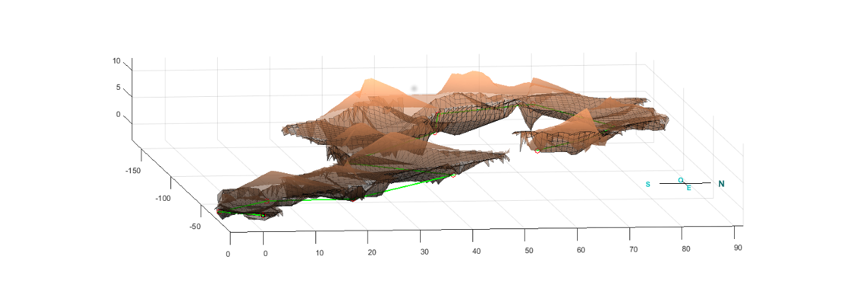
3D Cave
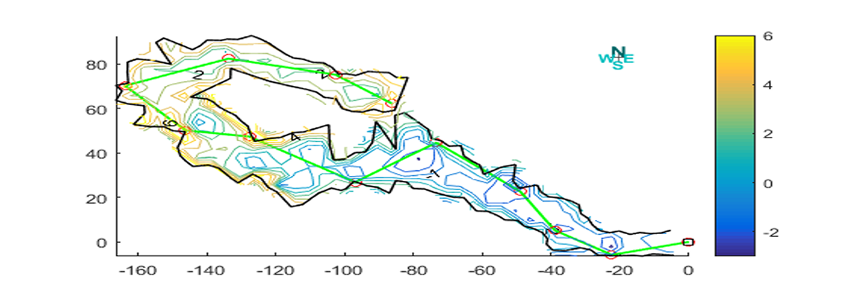
Countour
Cloud Form
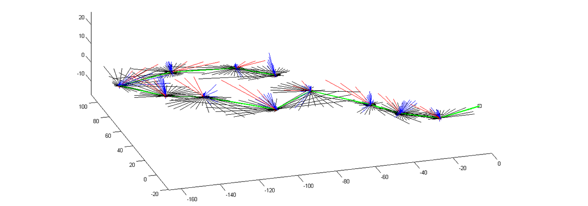
Vector Form
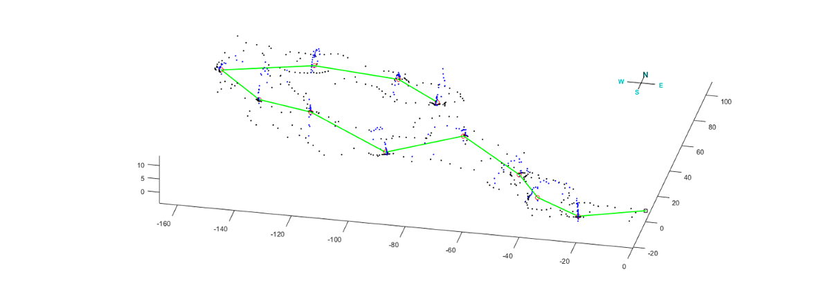
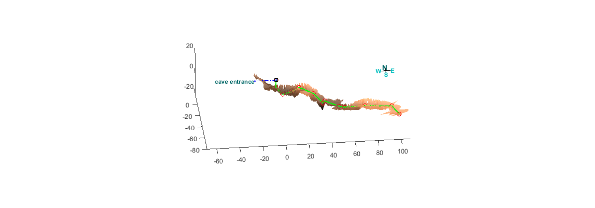
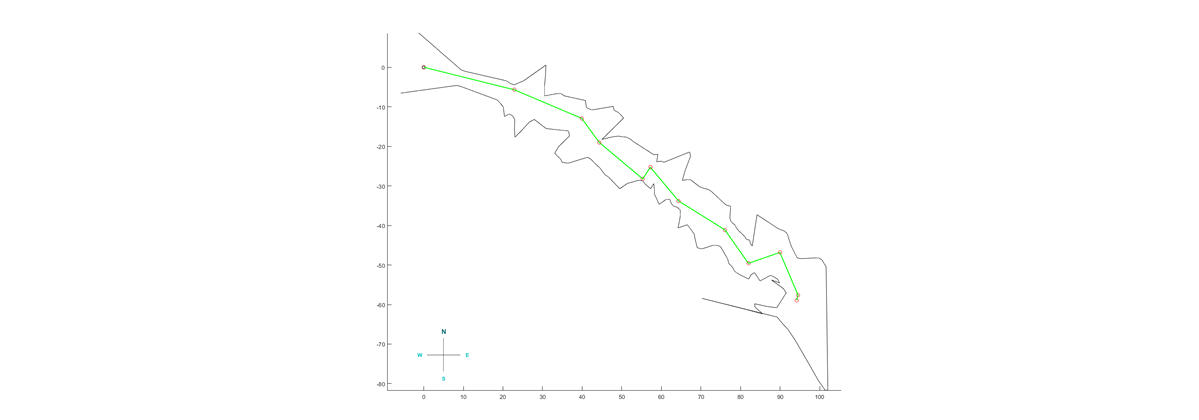
Lopez Cave:
Cross Section

Cave Station
3D Floor
.jpg)
.png)